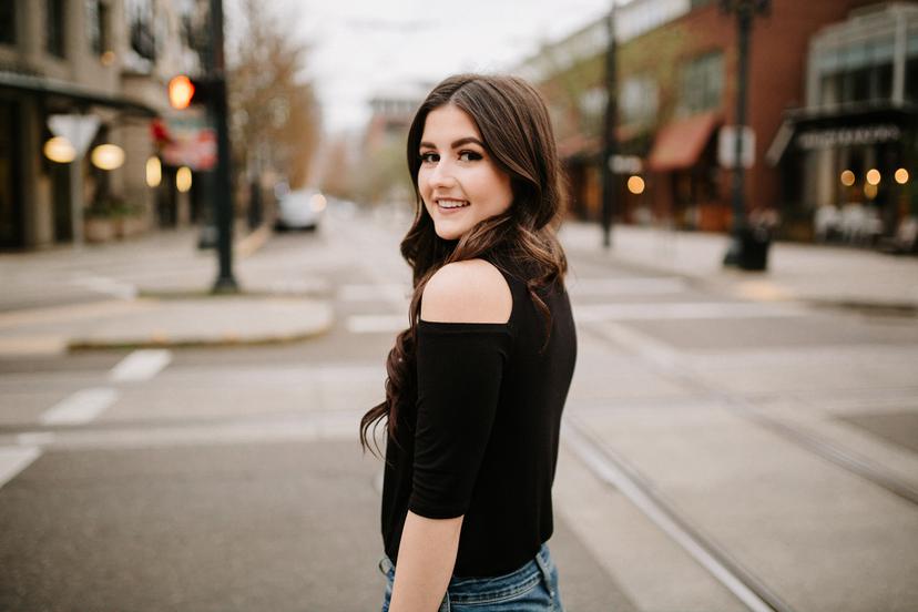
Best Portland Senior Photo Locations
(Updated for 2024) There are so many stunning senior photo locations around Portland, Oregon! I have been taking senior photos in Portland since 2008 and I’ve amassed a huge collection of beautiful places for my clients to chose from. I love working in both natural, and urban settings, and I truly believe that there is something for everyone! Honestly one of the hardest parts of planning your photoshoot is picking the location since there are almost too many good places to choose from. I hope looking through this list gives you some ideas. Please don’t hesitate to reach out to me if you have any questions or need help picking one of these!
How to choose a location
We all have places in our lives that make us feel relaxed and at peace, or places that hold special memories and meaning. For example, maybe you’re a swimmer and a place near water will instantly relax you. Or maybe you love thrifting with friends, and a particular part of town is full of fond memories for you. Choose a place for your photos that feels like YOU. I’m always happy to suggest ideas based off what you have in mind! You might not be familiar with all of these spots, but if you give me some general ideas (field, forest, city, near-water, or near a specific part of town), then I can send a few suggestions your way.
Here’s a list of my all-time favorite Portland senior photo locations, with photo examples for you to see!
See the locations on a map
You can also check out this map I made with all the locations listed below and a few images as well! Click “view larger map” in the upper right hand corner to see a detailed view in a new tab.
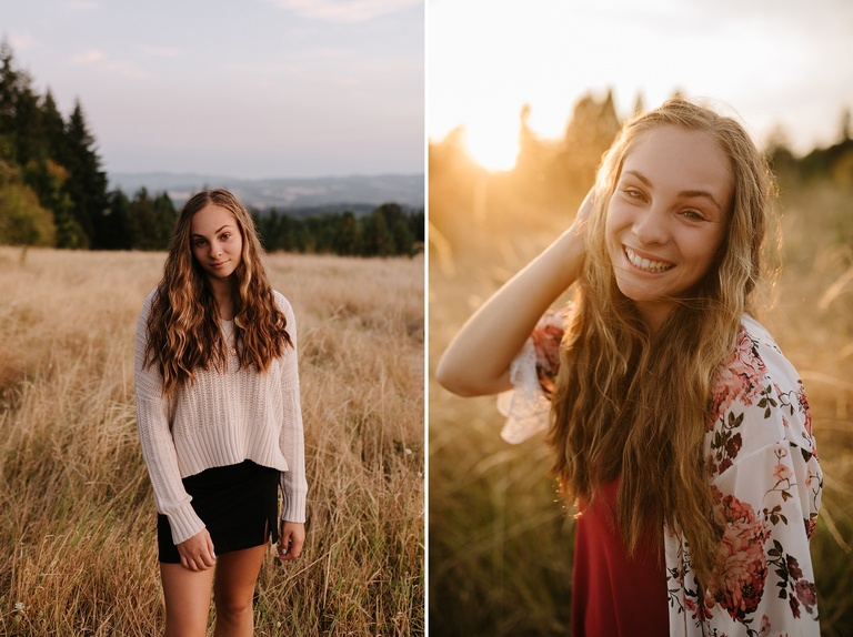
Portland Senior Photos in Nature
These are Portland senior photo locations that are close to town but you give you more of a natural feel! Want the moody look of a forest, or a beautiful open field without having to drive super far? These spots are for you! These are all park-like natural locations around the Portland metro area. You can find forests, flowers, fields, and water locations on this list.
Mt Tabor

What part of town: Southeast Portland. https://maps.app.goo.gl/SqxgeXUJfSnST4vX7
Location features: Mt. Tabor is a forested park in city limits that is actually an extinct cindercone! The park features evergreen forest, trails, a few open grassy areas, reservoirs, and views of the city. The reservoirs and stairs around the park do have a slightly old world feel.
Best seasons: Mt. Tabor is photogenic year-round because it predominantly made of up of evergreen trees. The prettiest season is fall when the leaves change and you have a great view of all the colors (early November is peak). Spring also lovely with little flowers blooming.
Other details to know: The roads in the park are always closed on Wednesdays year-round. In the summer, a local group hosts a Mt Tabor Rave on Wednesday evenings and the park gets VERY busy. Summer evenings on the weekends can be busy as many Portlanders enjoy a picnic and sunset here with friends.
Council Crest
What part of town: Council Crest Park is located in SW Portland, on top of the West Hills above Portland. https://maps.app.goo.gl/V6HtGsQtKxs93Ab86
Location features: Council Crest Park features an open grassy hilltop with predominantly deciduous trees, a round stone viewpoint at the top with views of the city and surrounding mountains on a clear day, and a forested area around the park with more evergreens.
Best seasons: Council Crest looks amazing in the fall when all the leaves change (early November). It will look a bit drab in the winter. Spring and summer are pretty too, with some flowers and green grass.
Other details to know: You can see the city and the mountains from Council Crest on a clear day, but it can be a little tricky for them to be a focal point in your portraits since the views are still a bit far away.
Powell Butte
What part of town: Powell Butte is located deep in SE Portland, closer to Happy Valley. Map: https://maps.app.goo.gl/HtXH2t3c9cq8YitF7
Location features: Powell Butte Nature Park is huge natural area with trails through meadows and grassy fields, with views of Mt Hood. There are patched of evergreen and deciduous forest areas, as well as a few overgrown orchards.
Best seasons: Powell Butte Nature Park looks best in spring, summer and fall. The grasses will be lush and green in the spring and early summer, and more rich and golden into the late summer and fall. It can be more drab in the winter. You can expect a few wildflowers here in the spring too.
Other details to know: Parking on weekends can be crazy! It’s definitely best at sunrise or sunset on weekdays.
Hoyt Arborteum
What part of town: Hoyt Arboretum is located in SW Portland in the West Hills, right by the Zoo and Washington Park. Map: https://maps.app.goo.gl/n9EEYFTeFHYhYfWYA
Location features: Hoyt Arboretum is a huge forested area adjacent to Forest Park in the West Hills of Portland. Because it is an arboretum, the forest is varied and cared for, as opposed to other parks around town where the forest is a little more uniform and wild. Hoyt features many different types of forest settings, including open meadows with views of conifers and surrounding hills, a redwood deck nestled amongst towering trees, deciduous trees with fall colors and spring blossoms, and lots of moody areas with ferns. Hoyt is one of my most popular locations and one of my favorite places in Portland to take photos.
Best seasons: Hoyt is very versatile and looks good year-round. In winter you get a lot of moss and lichen in the evergreen sections of the forest, and sometimes fog. There are pretty spring blossoms and lots of fall color. Summer is warm and beautiful. It’s probably prettiest in the spring and fall, but Hoyt is honestly one of my favorite spots to go during the drab winter months.
Other details to know: Hoyt is big, so anticipate some walking! On busy summer evenings, parking can be a little tough. You do have to pay for parking.
You can see more photos here and here and here or see what it looks like in the snow here!
Jenkins Estate
What part of town: Jenkins Estate is located deep in Beaverton near Hazeldale and Aloha. Map: https://maps.app.goo.gl/RN4ukzNSdWcxGKja9
Location features: Jenkins Estate is a large estate garden and park with a variety of locations. There are forested areas with a mix of evergreens and deciduous trees. There are rhododendron gardens filled with blooms. There are some large open lawns, a small japanese-style garden, flower beds, and a flower garden.
Best seasons: Jenkins Estate is beautiful in the spring because there are a lot of flowers! Many blooms last into summer as well. The variety of foliage also makes for great fall photos. I don’t recommend the park as much in the winter - most things will be dead and drab.
Other details to know: The park is occasionally closed because they host weddings and events here on weekends. There are two different parking lots, but either way you will end up walking up a hill because its a large area. Bathrooms are not very accessible and sometimes not open at all.
You can see more photos here or here or even more here!
George Rogers Park
What part of town: George Rogers Park is located along the Willamette River in Lake Oswego. Map: https://maps.app.goo.gl/XJf1Kiyj9rocXaUh7
Location features: George Rogers Park features a sandy beach area along the river, as well as a boat launch and rocky river area with some wildflowers. There is a forested section with a mix of deciduous and evergreen trees and a very very small waterfall. The park has a nice wooden bridge over a river that photographs nicely. There is also a historic furnace building made out of brick that works as a brick backdrop, an open grassy lawn, a few flowers, and bathrooms.
Best seasons: George Rogers park has some nice spring blossoms and daffodils each year. Summer is beautiful and warm (but busy). Fall has nice colors. Winter is a little drab.
Other details to know: In the summer months, the park can get busy on evenings with people picnicking and swimming!
You can see more photos at this location on my blog here or here.
Crystal Springs Rhododendron Garden
What part of town: Crystal Springs Rhododendron Garden is located in SE Portland in Eastmoreland. Map: https://maps.app.goo.gl/VtjtfbxvWd2wELA87
Location features: Crystal Springs Rhododendron Garden features waterside gardens, tons of rhododendrons and flowers, a unique arched bridge, and some forested areas. It’s more park-like than a true forest, but the lakes, paths and plants all look amazing in photos.
Best seasons: Spring, fall and summer. Lots of flowers in the spring and color in the fall.
Other details to know: This beautiful location does require a permit! You can find out more information on their website here. The fee is $35 per hour for 2 people (1 photographer and 1 client). It costs $10 per additional person per hour. Bigger groups of more than 11 people cost significantly more.
You can see more photos here!
Witches Castle in Forest Park
What part of town: Northwest Portland, off of Cornell Road in Forest Park. Map: https://maps.app.goo.gl/q5cWnPD49wivigwe9
Location features: Witches Castle is an abandoned historic structure in the middle of a ravine in Forest Park. You have to hike in about 1⁄2 of a mile to get there. The “castle”” is made of old stones, and is usually covered in colorful graffiti. The location in Forest Park means there are a ton of evergreen and deciduous trees with a very PNW feel. Balch creek runs through the ravine nearby.
Best seasons: Witches Castle looks best in summer, fall, and winter. Springtime brings vibrant green buds to the trees that add an almost lime-green color cast to photos, so it’s less ideal. In the winter, you can see a lot of the moss on the trees and it really gives it a cool atmospheric affect. The summer and fall are beautiful here as well.
Other details to know: The path to Witches Castle involves going up and down a hill on a narrow, muddy trail. Be prepped to hike 1-2 miles if you shoot at this location, and wear appropriate footwear. The parking lot off Cornell is a favorite spot for thieves - never leave anything valuable in your vehicle here.
Sellwood Riverfront Park
What part of town: Sellwood Riverfront Park is located on the Willamette River in Sellwood. Map: https://maps.app.goo.gl/RrLdQWmyY2z67dxX6
Location features: Sellwood Riverfront Park features a grassy meadow that is used as a dog park (beware of friendly, muddy dogs here!), a riverside sandy beach, and a strip of deciduous forest. There are also distant views of the Portland skyline and west hills from the beach. There are a few docks but they sometimes have old boats parked on them that make them less photogenic.
Best seasons: Summer and fall look best here! The forest looks pretty drab by winter since it doesn’t have many evergreens.
Other details to know: This is a dog park, so don’t pick this place if you are nervous around dogs.
You can see more examples here and at the end of this post here.
Dabney State Recreation Area
What part of town: Dabney State Recreation Area is located along the Sandy River in Troutdale. Map: https://stateparks.oregon.gov/index.cfm?do=park.profile&parkId=110
Location features: Dabney State Recreation Area is a beautiful riverside park along the Sandy River. The large park includes grassy lawns and picnic spots, sandy beaches, rocky beaches, views of a historic bridge, deciduous and evergreen forest patches.
Best seasons: Summer and fall are prettiest here! The winter usually makes the forest drab, and the Sandy river is more likely to be a brown color from the rain in the winter and spring.
Other details to know: Dabney is a State Park and requires a small day-use fee. Dogs are not allowed. In the summer, Dabney is a popular spot for swimming and floating the river, so it can get really busy on hot days and weekends. The park has a disc golf course!
Lewis and Clark State Recreation Area
What part of town: Lewis and Park State Recreation area is located along the Sandy River in Troutdale on the edge of the Columbia River Gorge. Map: https://maps.app.goo.gl/WbzTFWDamDXg9d3v8
Location features: Lewis and Clark State Recreation Area is another park along the Sandy River, close to Dabney State Park. This spot has an area with a combo of deciduous and evergreen forest and ferns. If you want more of a moody forested look, you can achieve it here in this section of forest against a hillside. The park also has access to the Sandy river with a boat launch on the other side of the main road. This part of the river is rocky with willows and views of a bridge in the distance. The main part of the park is flat and grassy with spaced out deciduous trees and picnic areas, as well as bathrooms.
Best seasons: Spring, summer and fall.
Other details to know: Unlike Dabney, Lewis and Clark State Recreation area does allow dogs and there is no day-use fee. It is also a popular swimming and floating spot, so it can get very busy on hot summer days and weekends. I am often okay with combining this location with Dabney because they are a 5 minute drive apart. Dabney is on a prettier section of the river, in my opinion. But Lewis and Clark still has a lot of amazing photo opportunities.
Howell Territorial Park on Sauvie Island
What part of town: Howell Territorial Park, also known as Bybee Howell house, is located on the western side of Sauvie Island, close to the Sauvie Island Bridge. Map: https://maps.app.goo.gl/meFawtNZdwu2ArXd7
Location features: Howell Territorial Park and Bybee Howell House consist of a sprawling 120 acre park with open fields, oak trees, a historic Classic Revival style house, orchards, a little bit of evergreen forest, deciduous forest, and a few flowers and farming areas. The park gives off homestead vibes and has a great variety of photo backdrops.
Best seasons: Spring, summer and fall.
Other details to know: There are no dogs allowed at the park, and the only restroom is a porta-potty. The park is usually pretty empty aside from other photographers!
Cooper Mountain Nature Park
What part of town: Cooper Mountain Nature Park is located in Aloha on Cooper Mountain, deep in Beaverton. Map: https://maps.app.goo.gl/bFazAM3BBZZkfsk17
Location features: Cooper Mountain Nature Park features beautiful tall grassy meadows, winding trails, some pine forest, oak woodland, and some mixed evergreen/deciduous forest. The park has meadow views that look out toward Oregon wine country in the distance. There are bathrooms in a big red barn-like building by the parking lot.
Best seasons: Spring, summer and fall. The grasses are green in spring, and they turn a beautiful golden color in late summer and fall. Winter will be very brown here.
Other details to know: Cooper Mountain Nature Park is VERY strict about staying on-trail, and even though you may be tempted to wander into the meadows, I always make sure to follow their guidelines to protect the delicate habitat! Also: dogs and pets are not allowed here, to protect the wildlife.
You can see more examples from shoots here!
Tualatin Hills Nature Park
What part of town: Tualatin Hills Nature Park is located in Beaverton near the Nike Campus. Map: https://maps.app.goo.gl/fWp1iutGqgQTXVxBA
Location features: Tualatin Hills Nature Park is a relatively flat and forested park with lots of evergreen trees, some deciduous trees, ferns, and some wetland. There are bridges and boardwalks as well as paved and unpaved trails. It’s a good option if you live close-by and want a forest location and don’t want to drive to Hoyt Arboretum or Forest Park.
Best seasons: This park typically looks good year-round. Some parts might be a little drab in the winter, but the moss, ferns, and evergreens make it pretty regardless of the season.
Other details to know: There are no dogs or pets allowed.
Check out more Tualatin Hills Nature Park photos here!](/blog/2019/01/22/portland-lifestyle-photographer/)
Tryon Creek Nature Park
What part of town: Tryon Creek State Park is located in the Southwest Hills of Portland near Lewis and Clark College Campus. Map: https://maps.app.goo.gl/jRenbwNPoTbdwSuG7
Location features: Tryon Creek State Park is a large forested park with evergreen trees, trails, ferns, streams, moss, and deciduous trees. It is similar to Forest Park and Tualatin Hills Nature Park: a protected patch of Pacific Northwest forest habitat for hiking.
Best seasons: Tryon Creek has enough evergreen forest and moss to look good year round. I tend to avoid it more in the spring when all the new leaves are bright yellow-green and create a lime-green color cast in photos.
Other details to know: This is a hiking location, so come prepared to walk! It can be muddy during the wet seasons. There are both paved and unpaved trails here.
Laurelhurst Park
What part of town: Laurelhurst Park is located in the heart of Southeast Portland in the Laurelhurst neighborhood. Map: https://maps.app.goo.gl/agovdSjhCgvTHqt47
Location features: Laurelhurst Park is a huge city park with a lot of variety. The park is mostly flat with rolling hills and includes grassy lawns, big trees (both evergreen and deciduous), a small lake, brick stairs, and lots of flowers and rhododendrons. There are many trees and abundant shady areas in the park, but the trees are evenly spaced enough that it doesn’t really feel like a forest - more like a park. The park also has adjacent tennis and basketball courts.
Best seasons: Spring, summer and fall are beautiful! There are a ton of flowers at Laurelhurst in the spring, and a lot of fall colors in the autumn months.
Other details to know: Laurelhurst Park is host to many summer events in an outdoor amphitheatre and those night can be CRAZY busy and packed - and impossible to find parking. The park also has a known issue with a number of unhoused Portlanders using the park and surrounding areas for camping. It’s usually pretty safe though. This park is also pretty busy during the warm summer months - a lot of people love to picnic and hang out here! It’s the least crowded in the early mornings.
International Rose Test Garden in Washington Park
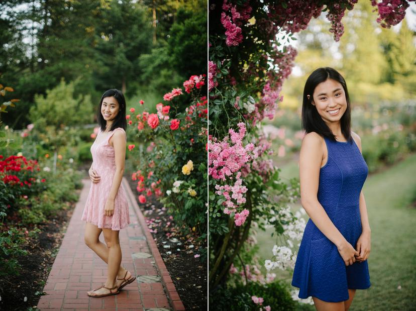
What part of town: The Rose Garden in Washington Park (also known as the International Rose Test Garden) is located in the West Hills on the border between NW and SW Portland. It’s just below the zoo, the Japanese Gardens, and Hoyt Arboretum. Map: https://maps.app.goo.gl/Bk5tQCYbdq8QA5JJ9
Location features: The International Rose Test Garden in Washington Park features over 10,000 varieties of roses in the late spring, summer and early fall. The park is full of flowers, some evergreen trees, arbors, fountains, benches, and a few forested areas. There are also tennis courts, a grassy outdoor amphitheatre, and distant views of downtown Portland and Mt. Hood.
Best seasons: This garden is highly seasonal! The roses don’t usually bloom until late May, sometimes not until June. They will continue blooming until fall, and they all get cut back in November. I do not recommend using this location between Nov-May because you will be disappointed!
Other details to know: There are occasional events and concerts at the Rose Garden Amphitheatre that can make parking impossible and totally overflow the park. This location is also a VERY popular spot for tourists and can get extremely busy in June when the flowers are first blooming. I recommend visiting on weekday mornings to avoid crowds.
There are more photo examples on my blog here!
Indoor Senior Photo Locations
Studio Portraits

What part of town: There are two studios I like to use in Portland, and they are both located in the New York building in the Northwest Industrial area. Map: https://maps.app.goo.gl/efck7gFudgKSH1n29
Location features: The studios I like to use, Daylight Creative Space and Cream Creative Space, are both natural light studios located in the New York building. The studios have huge windows with gorgeous lighting, white walls for clean studio portraits, and a huge variety of props and backdrops to choose from.
Daylight Creative Space has a ton of colorful backdrop options and a lot of different chairs, couches, stools, plants, and other props. The window light is soft and its easy to create a variety of looks!
Cream Creative Space has more direct light in the afternoons, better for creating moodier, dramatic portraits. This studio also has more dramatic black and white backdrops and some really unique custom-built and modern props. Its great for something a little artsy or moody!
Best seasons: Booking a studio is an amazing option year round! It’s especially ideal when its hot in the summer and cold in the winter.
Other details to know: My studio sessions cost a little extra to cover the cost of the studio rental, but it is SO worth it to have a blank space to create in, all to yourself! This is such a great option if you really want privacy and don’t want an outdoor location with bystanders, or if you want to book a session during a time of year that is really rainy.
Parking Garages
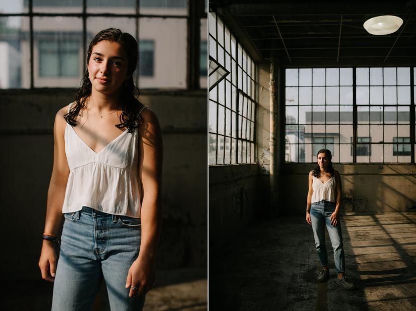
What part of town: My favorite parking garages are located in Northwest Portland in the Pearl district.
Location features: This unique parking garage is in an old industrial warehouse building. It definitely gives off beautiful, abandoned, industrial vibes. There is a ton of natural light that come in through the windows, and lots of gritty little areas that are perfect for photos. It’s great if you want a look that really stands out and is different!
Best seasons: This is great year-round, but it can get SUPER hot in the summer.
Other details to know: Because this is a literal parking garage, there is always a slight risk we won’t be able to access it! Sometimes the garage has weird hours, and since it is a privately operated garage, sometimes that means we can’t get in. There is always a risk they can ask us to leave too. I’m always very respectful here and try my best to work quickly and not bother anyone. If you are up for a little adventure, it’s a really fun and unique photo location. I have never been kicked out of this location for taking photos, but I am always on my best behavior and try to be as respectful as possible in case someone asks us to leave.
Here are some more photos on the blog, plus some more here and here.
Urban Senior Photo Locations
These urban locations are perfect for colorful, fun, and stylish Portland senior photos that show off the Portland vibe and spirit! I’m confident that I can create interesting imagery in almost every pocket of our city.
Pioneer Square

What part of town: Pioneer Square is located in the heart of downtown Portland. Map: https://maps.app.goo.gl/YcnACrtCu547edWd9
Location features: Pioneer Square is an open brick square in the heart of downtown Portland. A lot of the buildings around the square are older and this part of town has a more timeless feel to it! This is great if you like more historic Portland architecture and the true feeling of being downtown and surrounded by skyscrapers.
Best seasons: This urban location looks good year round. Late fall is probably prettiest with the changing leaves, but the urban environment lends itself well to all seasons.
Other details to know: As with many urban places in Portland, you can expect to come across people who are unhoused and potentially mentally ill or doing drugs. The best time of day is definitely early morning when the square is less busy. Just keep your wits about you and you will be fine. The square is also a popular spot for events, which is another reason it’s best first thing in the morning!
Eastbank Esplanade and Hawthorne Bridge
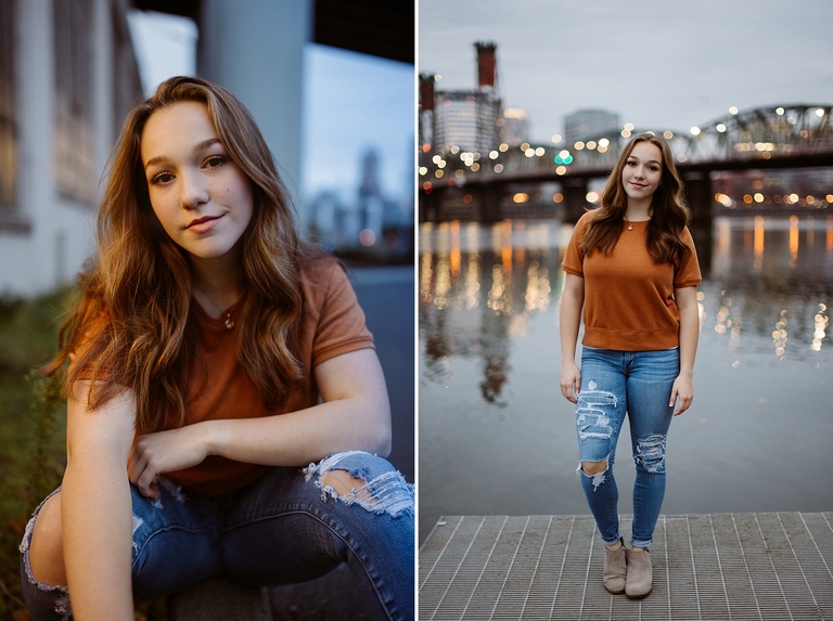
What part of town: This part of the Eastbank Esplanade is located on the Southeast side of the Willamette River, near OMSI and the Hawthorne Bridge. Map: https://maps.app.goo.gl/ruf5oarDKzudn4TZ9
Location features: The Eastbank Esplanade has arguably some of the best views of the Portland city skyline. If you want the iconic Portland city in your photos, this is one of the best places to do it! The esplanade includes some riverside spots, a dock, access to the Hawthorne Bridge for bridge photos, as well as some industrial backdrops under the Marquam bridge, and along various walls in the area. It has great variety for photos. Bonus? Some of the spots under the Marquam bridge are somewhat rain protected!
Best seasons: The iconic city views look good year round - but there is one kicker. The Willamette River tends to turn brown in the rainy months! If you want a blue or green river, your best bet is late spring, summer, or early fall.
Other details to know: There are lots of homeless encampments in this area, so be prepared for that. The esplanade is a busy bike path, so we always want to be respectful (and cautious!) about bikers whizzing past. If we take photos on the bridge, we also will need to be careful for bikes, and anticipate that drivers often get excited when they see a photoshoot happening and may honk at you! Sometimes this is a popular location and we may need to wait our turn around sunset if there are other photoshoots happening at the same time. In the hot summer months, a lot of Portlanders will use the popular dock at the spot for swimming! So it can get busy. This location is beautiful at sunset, but definitely pretty busy around that time. If you want less crowds, sunrise or even a little before sunrise is a great bet.
Want more examples? Check out this post on my blog! You can see more photos of the Hawthorne Bridge here!
Broadway Bridge
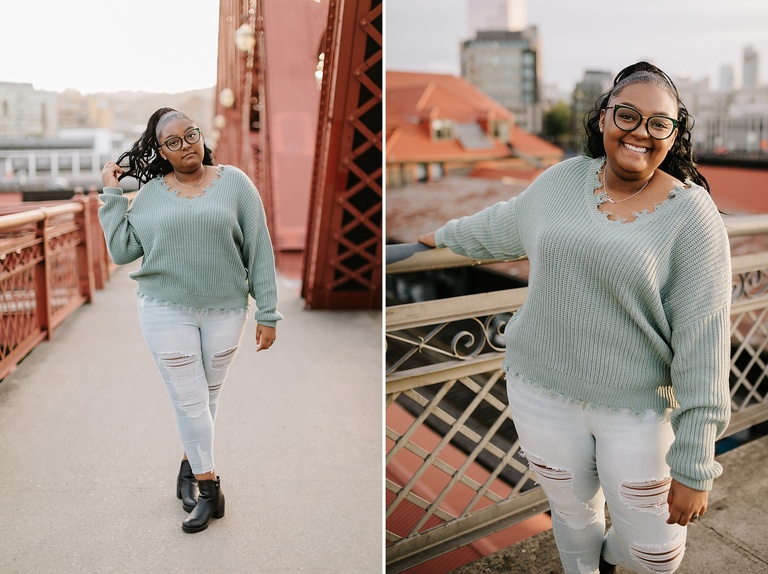
What part of town: The place where we accesss the Broadway Bridge is in Northwest Portland, in the Pearl district. Map: https://maps.app.goo.gl/2uHCDkSVhDhvZH8NA
Location features: The Broadway Bridge is another great spot for iconic views of Portland. The bridge is a gorgeous reddish brown color that looks amazing in photos. Walking up Lovejoy to get to the bridge gives you views of the Pearl district and the Portland skyline. Once near the bridge, you can also get shots with the train station tower. There is an old brick building right next to the Broadway Bridge with great texture. This location is walking distance from other spots in the Pearl and allows you to combine both for a lot of variety in one shoot.
Best seasons: The Broadway Bridge looks great year-round. Because you are up a little higher on a bridge, it can get windy and cold in the winter. But this urban environment lends itself well to all seasons.
Other details to know: The Pearl district usually has less homeless populations than other parts of the city, but there are still a good number of mentally ill and homeless people that hang out near the train station. When we take photos on the bridge, we will be extra careful for bikes who use the sidewalk and speed by. Expect to get honked at - people love to see a photographer out on the bridge and honk their approval!
See more examples on my blog at the end of this post here.
The Pearl District
What part of town: The Pearl is located in Northwest Portland near downtown. Map: https://maps.app.goo.gl/uKjSbuJf8VuK862K7
Location features: The Pearl District is beautiful, clean, upscale part of Northwest Portland with tall skyscrapers, pretty parks, coffeeshops, and interesting walls and architecture. The buildings are a mix of modern and historic, with some industrial vibes as well. Tanner Springs Park has a little pond with grasses and native plants, and a unique metal sculpture along a sidewalk. There are lots of wooden boardwalks in the area that differ from regular sidewalks in the city. There is a cool parking garage in the Pearl that has nice views from the roof too.
Best seasons: The Pearl looks great year round because it’s mostly urban. It will be slightly more photogenic in spring, summer, and fall when there are leaves on the trees, but it still works even in winter.
Other details to know: It’s easy to combine the Pearl District with the Broadway Bridge! They are all in the same area in walking distance. There are usually less homeless people in this part of town, compared to other urban locations. If you want more privacy for your urban photos, I recommend taking them closer to sunrise!
You can see more Portland Pearl district senior photos here!
Alberta Arts District

What part of town: Alberta is a street and popular artistic neighborhood in Northeast Portland. Map: https://maps.app.goo.gl/WAoD46P3aJ3ocF766
Location features: Alberta Arts District has so many colorful walls, buildings and murals! It has a really playful artsy vibe that photographs really well. This area is great for a casual Portland vibe without the overt Portland city skyline or bridge look. You can walk up and down Alberta and find a ton of different plants, restaurants, murals, and pockets of light. There are lots of coffeeshops and cute stores here too!
Best seasons: You can take photos here year round. It probably looks slightly better Spring-Fall, but even in the winter you can make it work because there are so many colorful walls and interesting buildings that the plants are less of a focal point.
Other details to know: There are street fairs here on summer evenings and it can get really busy! Mornings are ideal for less crowds.
Cathedral Park
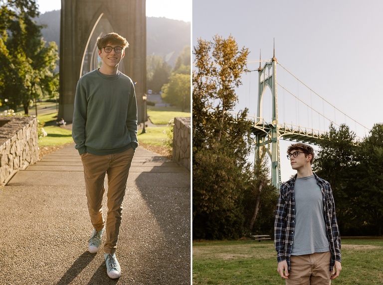
What part of town: Cathedral Park is located in North Portland, underneath the St John’s bridge. Map: https://maps.app.goo.gl/Nwd8QWiH8MjXscnj6
Location features: Cathedral Park has a ton of variety. You can take photos under the bridge with the iconic pointed arches. You can go up on top of the bridge (it takes a little while to walk up, but it’s worth it!) and get photos with more arches, spires, and Forest Park in the background. You can wander around the park and get beautiful shots with the bridge in the background. There are huge grassy fields, deciduous trees, and river access. The riverside is somewhat sandy, with some small stones. There are several docks to take photos on. There are a few industrial buildings right next to the park with some graffiti, colorful walls, and murals. There is also an amphitheatre in the park with a gray painted wall that works well as a neutral background.
Best seasons: Spring, summer and fall. It will look pretty drab in winter.
Other details to know: Right now they are doing a big construction project to repair the St John’s Bridge. If you want to take photos here, you absolutely should go scout it ahead of time and see what the current construction looks like because it will probably impact how photogenic the bridge and park are. You can find out more info here: https://www.oregon.gov/odot/projects/pages/project-details.aspx?project=37899 The expected completion date is Feb 2025.
Also, Cathedral Park gets very busy on summer evenings for concerts and other Portland events. This location is also quite popular for photographers, so expect you may need to wait your turn at some of the more popular locations. In the summer and fall, there are usually several photographers here at a time!
You can see more examples here!
Burnside Bridge
What part of town: The Burnside Bridge is central in downtown Portland and is the dividing line between the north, south, east, and west quadrants of the city. Map: https://maps.app.goo.gl/2pyX6S58H35jvCUK9
Location features: The Burnside Bridge is a great location for iconic Portland photos. On the west side of the bridge, you have the famous Portland Oregon white stag sign. On the middle, you get great views of the city skyline in both directions, and on the east side, there are a bunch of cool buildings, walls and great textures. It’s a really versatile location for views and urban imagery.
Best seasons: This location looks good year round! It’s mostly concrete and urban structures so it works great in any weather.
Other details to know: I usually park on the east side of the bridge on MLK, start in that vicinity, and then walk over toward the west side. The west side of the bridge is home to numerous rescue missions for the unhoused, and there are usually a number of mentally ill, and unhoused individuals in the area. For this reason, I usually stay a little further east side on the bridge, but it is up to every clients comfort level! Taking photos on the bridge is fun, but you may get honked at!
You can see more examples on this blog!
Lillis Albina Park

What part of town: Lillis Albina Park is in North Portland. Map: https://maps.app.goo.gl/21A1qzXB9YnY8Eb96
Location features: Lillis Albina Park is a small park in North Portland with views of Downtown. It’s claim to fame is a basketball court with clear views of the city through a chain link fence. This is such a great spot for anyone who loves basketball and wants that court-feel, but with some urban grit and views!
Best seasons: The main draw of this park is the basketball court, which really looks good any time of year.
Other details to know: The park and basketball court are part of a school, so we just need to be sure there aren’t any conflicting uses of the court and park while we are taking pictures! The park is also dog-friendly, so it’s not a great location if you don’t love dogs!
Tilikum Crossing Bridge
What part of town: The Tilikum Crossing bridge spans between OHSU on the South Waterfront, and OMSI on the east side of Portland. Map: https://maps.app.goo.gl/vKpmfeipcVmXRr2x5
Location features: Tilikum Crossing is the newest bridge in Portland, with a modern look and feel, striking lines, and great views of the city. It’s most easily accessible from the east side, where there is a bit more parking. The bridge is only for public transit and pedestrians. It’s a great spot if you love Portland views and want a more modern bridge look!
Best seasons: The bridge looks great year round!
Other details to know: While taking photos on the bridge, it’s important to stay in the pedestrian lane and watch out for bikes.
Inner Eastside Murals on Stark

What part of town: There are a ton of murals on Stark Street between Water Avenue and SE 12th Ave. Map: https://maps.app.goo.gl/24PAefUKSvWjqYcn7
Location features: Stark Street has some great street art and murals in the Central Eastside Industrial Area. This is great for colorful, urban looks with graffiti and murals, as well as lots of textures! The area closer to Water Ave is more industrial, and as you go east you find more murals and food cart pods. If you want more of a gritty feel, this is a great spot.
Best seasons: This area looks good year round because the focus is mostly on the walls, not the plants!
Other details to know: There are some homeless camps closer to Water Avenue, and this is an urban location so you never know who will be around! As will all urban locations in Portland, it’s good to keep your wits about you!
Senior Photo Locations Outside of Portland
Crave something adventurous? These portrait locations are a further drive, but they are so worth it!! The Pacific Northwest has so many beautiful places to explore and I’m always down for a fun road trip! Just note that some of the spots on this list incur a small travel fee - which I have included here!
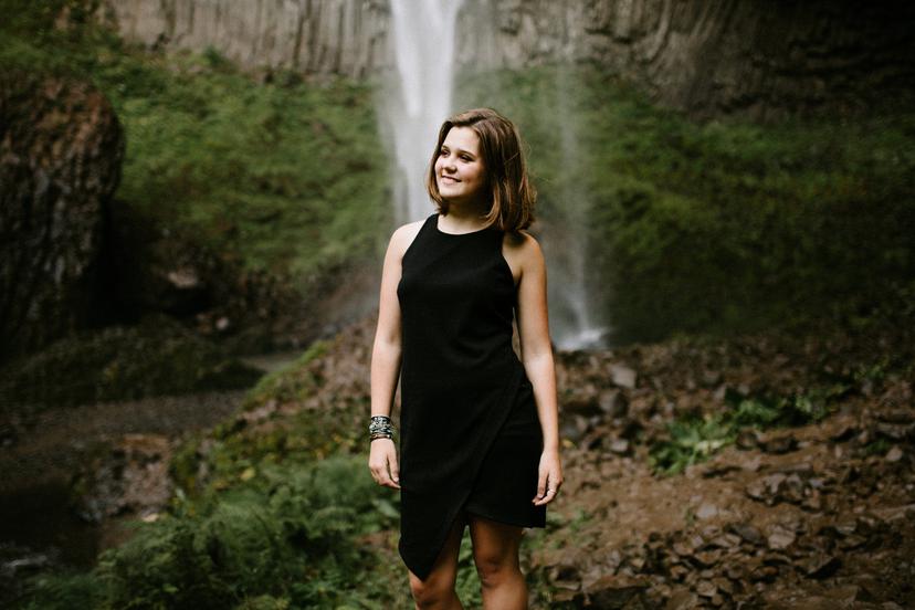
Latourell Falls
What part of town: Latourell Falls is located on the western side of the Columbia River Gorge on the historic highway, near Corbett. Map: https://maps.app.goo.gl/E8miFZSfDwQGrbVi6
Location features: Latourell Falls is my go-to waterfall location! It is one of the closest, and biggest, waterfalls near Portland! It is stunningly beautiful and only 30 minutes outside of town in the gorge. The walk from the car to the falls takes less than 10 minutes on a gravel path. If you want your photos near an epic waterfall, this is a great option! The area near the falls has a beautiful bridge and lush forest, and the falls themselves are very photogenic and quickly accessible.
Best seasons: Latourell Falls looks great year round, even in the winter. Each season brings its own benefits. In spring everything is very lush and green. In summer, it’s still lush and you have warmer temperatures which make the falls more fun (though the falls tend to shrink in the summer). In the fall you get amazing colors here! And in the winter all the moss on the trees is visible and there is a lot of mood.
Other details to know: This is a popular tourist spot (but not as popular as Multnomah Falls). I usually take photos at sunset or sunrise on weekdays to avoid crowds!
Travel Fee: Nope!
You can see more pictures on the blog here and here!
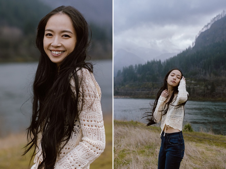
Women’s Forum and Crown Point
What part of town: Crown Point and Women’s Forum are both located near Corbett on the historic Columbia River Highway, about 30 minutes east of Portland. Map: https://maps.app.goo.gl/7ZPX3wiyjP25AiuU7
Location features: Crown Point and Women’s Forum are two of my favorite viewpoint locations in the Columbia River Gorge. You drive along the historic highway and are rewarded by these astounding views looking down at the gorge and the mountains all around you. Women’s Forum is first as you drive east, and its is less popular and usually less crowded. It has a grassy area, eastern views of the gorge, and some trees and forest. Crown Point is only 3 more minutes down the road and offers more panoramic views both east and west. The viewpoint is home to the Vista House, a round, photogenic historic building, with stairs circling it. Crown Point is a more popular tourist destination and can get more crowded.
Best seasons: Both locations work year-round since most of the focus is on the view, not the plants right around you. In the spring everything is green and verdant. In the fall you can see a ton of color! Summer is nice, but wildfire season does destroy the views a bit. Winter is also beautiful, just cold, and sometimes too foggy to see much!
Other details to know: Both of these spots are WINDY! Be prepared for some wind unless you get a rare calm day in the gorge. Also, neither spot has a bathroom. Crown Point can get busy with tourists and is usually best at sunrise.
Travel Fee: Nope!
Dalton Point
What part of town: Dalton Point is located in the Columbia River Gorge, just west of Multnomah Falls. Its only accessible from Interstate 84 Westbound, which means if you are coming from Portland, you have to drive past it, turn around at the next exit, and return toward Portland to find this spot. Map: https://maps.app.goo.gl/5gFvDP9xjEGSn5bU7
Location features: Dalton Point is a nondescript boat launch along the Columbia River that looks beautiful in photos. There’s a little rocky beach on one side that has amazing views of the cliffs and mountains too. It’s great for photos right along the water, in the willows, and with views of the surrounding gorge towering around you! There are also some flat, grassy areas and pretty deciduous trees near the parking lot.
Best seasons: Dalton Point changes a LOT depending on how high the water level is! It works best in drier months or whenever the river is low so you can walk out on the rocks for the best views. Best seasons are late summer and early fall before the water levels get high again!
Other details to know: This is an active boat launch, as well as a small rest stop that some truckers use along highway 84, so I am always careful around anyone else who is there!
Travel Fee: Nope!
You can see more photos from this shoot here!
Government Cove
What part of town: Government Cove is a small peninsula in the Columbia River located just east of Cascade Locks in the Columbia River Gorge. The peninsula is accessible by driving through Cascade Locks and taking the frontage roads along highway, or from I84 Westbound, meaning that you pass it going east, turn around at the Wyeth exit, and then get off at the Forest Creek/Herman Lane exit. Map: https://maps.app.goo.gl/xpgFerwx3FLYxn8u9
Location features: Government Cove is a wild, stunning, beautiful peninsula right on the Columbia River. You park before the gate at the little cove, and on a calm day there are reflections of the mountains before you. As you walk up the peninsula you find tall grass, panoramic views of the river, moss-covered cliffs, wildflowers, a few trees, and dramatic scenery all around.
Best seasons: Government Cove looks lovely year round. In the spring the grass will still be green and you may catch some wildflowers. In the summer it turns golden and beautiful, in the fall you get some color in grass and trees, and in the winter the stark landscape, moss, and moodiness of the gorge dominates the imagery.
Other details to know: This place can get WINDY because it is very exposed along the river! Always check the weather and be prepared to have your hair and clothing blow in the wind here! It is beautiful to work in the wind -it’s just good to be mentally prepared in advance! This location is always occasionally used for commercial shoots like car commercials, and I have seen it entirely rented (with no warning!) when you arrive. Also - it’s best to park near the gate and walk up as opposed to driving all the way onto the peninsula. The gate is usually closed and it’s supposed to stay that way. There are also no bathrooms here!
Travel Fee? $50
Hamilton Island
What part of town: Hamilton Island is located in North Bonneville on the Washington side of the Columbia River Gorge. I like to access it near the baseball fields! Map: https://maps.app.goo.gl/NPa4XoZ7J7QPBPFb9
Location features: Hamilton Island is somewhat similar to Government Cove. This beautiful location is wide open with tall grass and spectacular views of the surrounding mountains, as well as Beacon Rock and the Columbia River.
Best seasons: You’ll get the prettiest looking grass in spring, summer and fall here, but this location is still pretty even in winter! The views look good year-round even if the grass is more dead and brown.
Other details to know: The closest bathroom is on the other side of the island near the boat ramp (its a pit toilet). There isn’t one at the baseball field entrance.
Travel Fee: $50
Haystack Rock
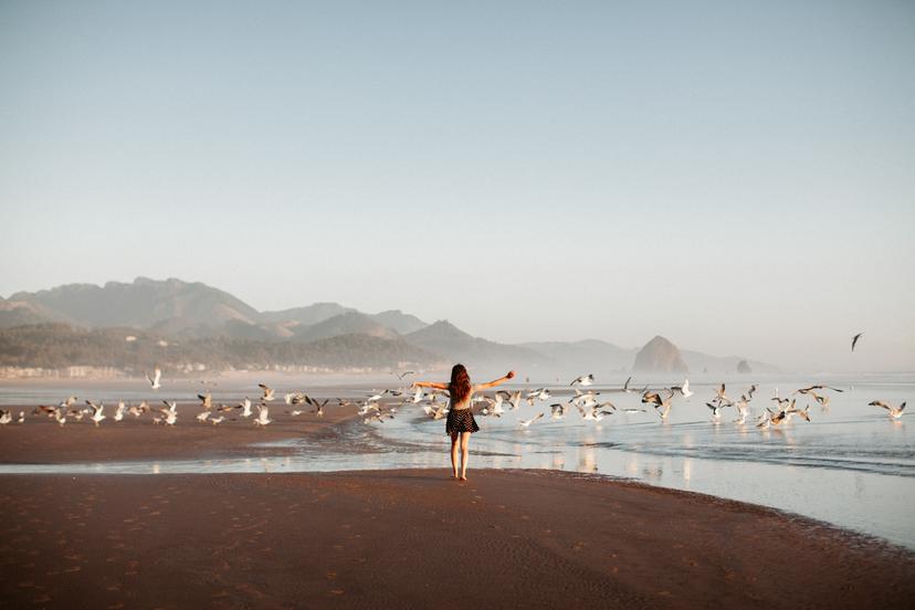
What part of town: Haystack Rock is located in Cannon Beach on the Oregon Coast. To take photos next to the rock, I usually park at S. Hemlock and Coolidge Ave, and then walk onto the beach from there!
Parking map: https://maps.app.goo.gl/otFEjkjrZyPgd8nH8
Haystack rock map: https://maps.app.goo.gl/cHk4zsEDi4YZgKzx9
For people who want Haystack Rock in their photos but don’t want to be super close/have all the crowds, the alternative is to go to this northern spot in Cannon Beach, north of the river, and access the beach from the sand dunes here. You can see the rock without getting as many crowds this way!
Alternative North Cannon Beach location map: https://maps.app.goo.gl/GS482njyjCes4Rh97
Location features: This iconic rock in Cannon Beach always manages to steal the show! It looks so good in photos and it even has puffins living on it part of the year! It is a massive, iconic sea stack on a huge open beach. It’s easy to get close to the rock and take so many dramatic photos on this beach!
Best seasons: Haystack Rock looks great year round. You may get warmer weather in the summer, but also way more crowds! For this reason I’d say its actually best in fall, winter, and spring.
Other details to know: Cannon Beach can get very busy in peak summer months and on weekends! I recommend going to this location at sunrise if possible, or doing sunset in the off season or on a weekday. If you don’t want anyone around, it’s great to opt for the northern part of Cannon Beach instead, where you can still see Haystack in the distance, but you are removed from all the crowds. Plus there are more dunes with beach grass!
Travel Fee: $125
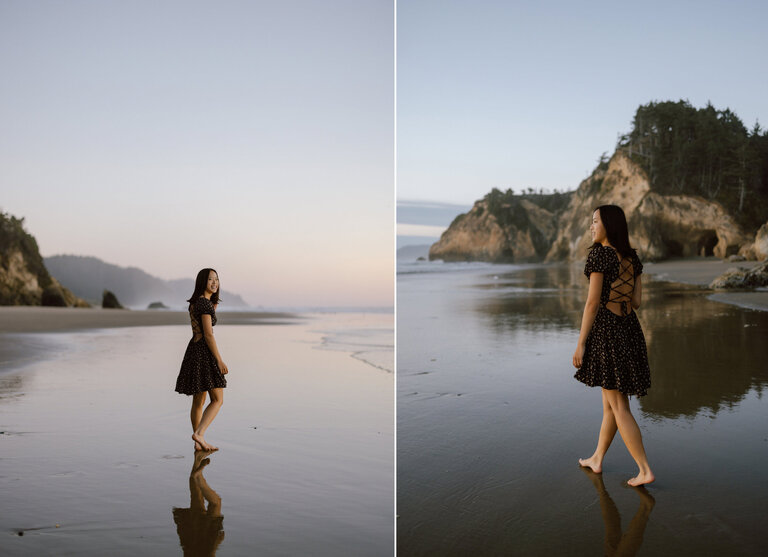
Ecola State Park
What part of town: Ecola State Park is located directly north of Cannon Beach on the Oregon Coast. Map: https://maps.app.goo.gl/D9nKMLtVW4C3FetU7
Location features: Ecola State Park is basically 3 amazing locations in one. The main viewpoint at Ecola State Park has stunning views of the Pacific Ocean and Haystack Rock from a distance. Also, the forest in Ecola State Park is probably my favorite forest in the world, and I don’t say that lightly. It’s like Jurassic Park in there! It looks sooo good in pictures! I especially love it on foggy days. PLUS, Ecola also has this incredible beach called Indian Beach that’s hardly ever busy! It has craggy cliffs, beautiful stones, as well as lots of driftwood. It’s a magical place tucked away at the end of bumpy gravel road. All three locations are amazing for portraits!
Best seasons: Ecola State Park truly looks good year round. In the winter, the moss in the trees really shows off and the mood of the place is pretty magical - you just have to make sure that winter storms haven’t closed the park. Spring, fall, and summer are gorgeous. Summer is the most popular season for visitors and you will likely have a more crowded park at this time, but it’s still not anywhere near as crowded as the main beach in Cannon Beach.
Other details to know: If you want the park to yourself, I recommend a sunrise shoot here! Also, it costs $5 to park, or you can use a state parks pass if you have one. There are public, flush toilet restrooms at the first viewpoint location too.
Travel Fee: $125
You can see more photos on my blog here.
Hug Point
What part of town: Hug Point is located just south of Cannon Beach on the Oregon Coast. Map: https://maps.app.goo.gl/HwrqY65LsECcRBLd9
Location features: Hug Point is a scenic beach on the Oregon Coast that features dramatic rocks, orange cliffs, forest, a wide-open sandy beach, and a waterfall! If you want to access the waterfall, you have to make sure to go near low-tide. Even if you don’t make it to the waterfall side, the main beach area is still gorgeous and offers a ton of variety for photos.
Best seasons: Hug Point looks good year round! The trees are mostly evergreens so this location really shines at any time of year. It’s less busy in fall, winter and spring!
Other details to know: The waterfall on the beach is only accessible at low-tide, and the waterfall looks best during the rainier months of the year! It tends to dry up in the summer months.
Travel Fee: $125
Timberline
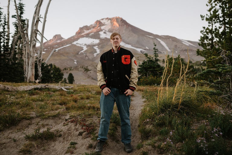
What part of town: Timberline is a historic lodge and ski area on Mt Hood. Map: https://maps.app.goo.gl/7bVQKJDQ5YGYMTcZ7
Location features: Timberline Lodge and the surrounding area is an amazing spot for portraits featuring Mt Hood! This ski area is one of the highest spots you can easily get to on the mountain. It has incredible views of the cascades since you are up so high. If you love the snow or you love the mountain, this is a great option!
Best seasons: Winter and mid-late summer! In true winter you get magical snowy photos. In true summer, when the snow melts, you can walk onto the Pacific Crest Trail and get photos with wildflowers and grasses. Avoid the slushy shoulder seasons - spring and fall won’t be as photogenic here!
Other details to know: Since you are up at a higher elevation above the tree line, Timberline can get quite windy! If you go in the winter, make sure to bring appropriate footwear for walking in snow.
Travel Fee: $75
Want to know more about my senior and portrait sessions? Check out my my pricing and info page, or contact me!